UK Set for Warm Weekend: Temperatures to Surpass Ibiza

As spring finally makes its entrance after a turbulent winter filled with hail, thunder, and even snow, the UK is gearing up for a weekend of unseasonably warm weather. Temperatures are forecasted to soar, possibly exceeding those in the popular Spanish holiday destination of Ibiza.

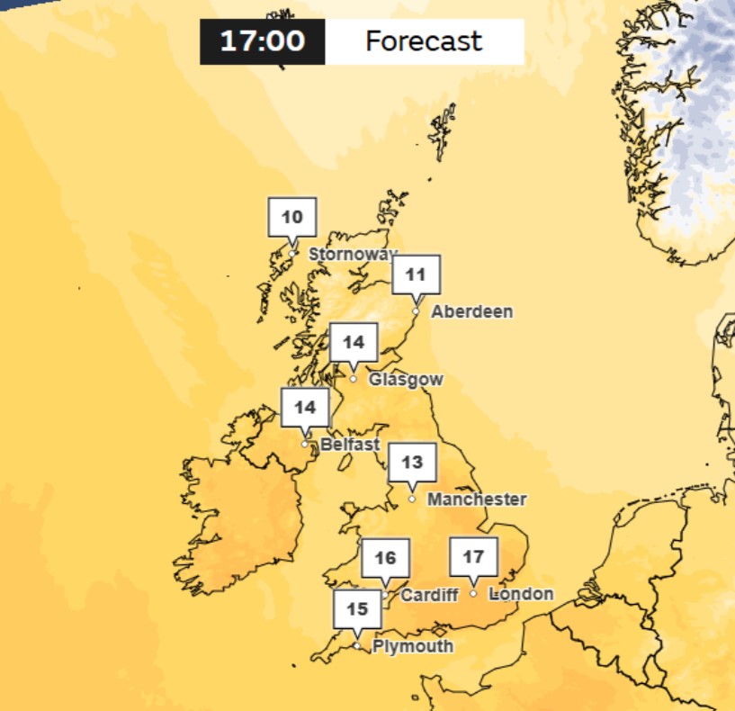
Starting tomorrow, parts of the UK are expected to reach a delightful 17°C, which is a whole degree higher than the forecasted temperatures for Ibiza. This marks the beginning of what could be a brief but pleasant mini heatwave, with the mercury expected to climb even further in the days ahead.
According to Met Office senior meteorologist Greg Dewhurst, “There is still some uncertainty regarding the peak temperatures for next week. However, as we move deeper into next week, we can anticipate temperatures rising into the high teens, and in some areas, we may witness temperatures reaching the very low twenties of Celsius (20-22) across several locations in northern and western parts of the UK by midweek.”

This warm spell coincides with a partial solar eclipse expected to be visible in various regions of the UK on Saturday morning, just as the clocks spring forward. After enduring a bitter winter and some unusually chilly spells this month, residents can finally look forward to sunshine and warmth.
The southeast of England is anticipated to experience the warmest temperatures next week, with parts of south-west Scotland, the West Midlands, and north-west England also likely to enjoy the peak warmth later in the week. This rise in temperature comes after a brief period of unsettled weather that the Met Office described as typical for spring.
Despite the promising daytime warmth, the clear skies at night may lead to chilly evenings and even the possibility of rural frosts. Met Office meteorologist Honor Criswick elaborated, “We are set to experience a short-lived spell of unsettled weather this weekend, but a transition back to a blocked weather pattern is expected as high pressure builds on Sunday, dominating our weather for much of the upcoming week.”
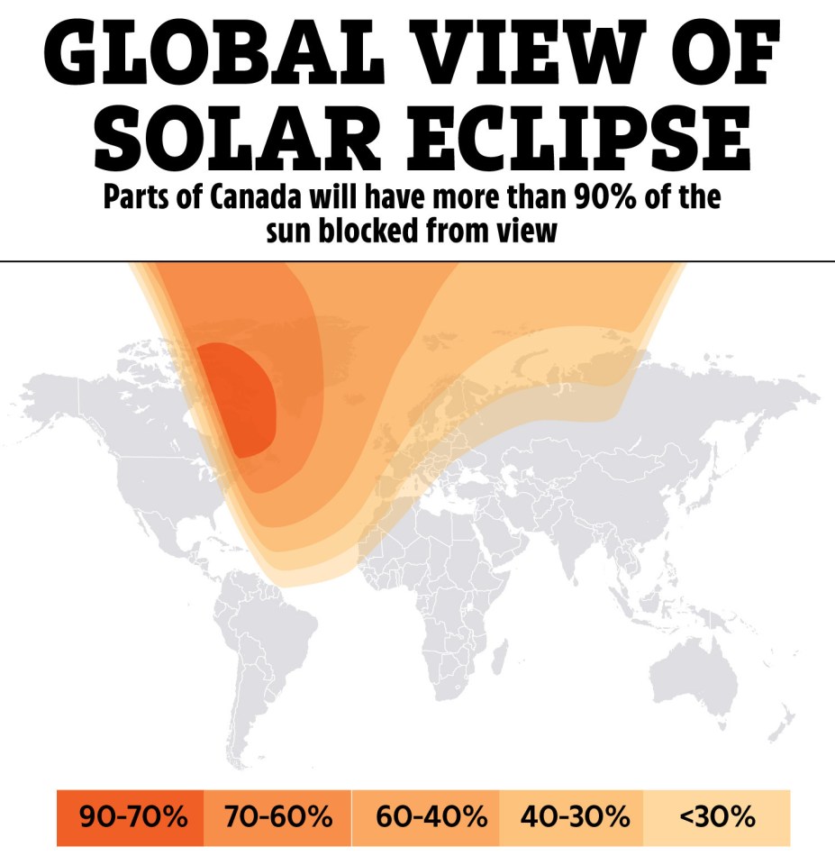
While daytime temperatures may be pleasant, nighttime will still be cool, and there remains a chance for rural frosts under the clear skies. The improving conditions in some areas of the UK could provide an excellent opportunity for those hoping to catch a glimpse of the partial solar eclipse on Saturday morning, where the Moon will pass between the Sun and the Earth, partially obstructing the Sun’s rays.
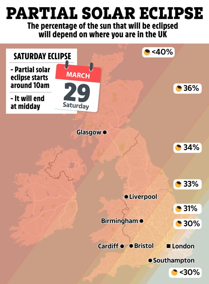
The eclipse is predicted to be visible in the UK from 9:56 AM to 12:14 PM on Saturday, with maximum coverage — the point at which the most significant percentage of the Sun is covered — occurring at 11:03 AM. Different regions across the UK will experience varying levels of eclipse coverage. For instance, north-west Scotland’s Gallan Head is expected to witness the most significant coverage at 47.9%, whereas Dover in south-west England will see the least at only 28.1%. Manchester is forecasted to have 36.1% coverage.
Met Office meteorologist Alex Burkill noted, “The further north-west you are in the UK, the more substantial the eclipse will be, whereas in the south-east, it will be slightly less, but still significant at around 30%.” Cloud cover maps from the Met Office indicate that south-east England should enjoy clear skies when the eclipse begins, while Manchester and north-west England might experience partial cloud and rain, and most of Scotland will be under cloud cover.
Ms. Criswick added, “Unfortunately, those in the South-East will only witness about 30% of the eclipse, while areas further north-west could see around 50%. However, cloud and rain in those areas may hinder visibility, leaving little chance of seeing the event there.”
Five-Day Weather Forecast

- Today: A dry but chilly start for many, especially in the southeast where sunshine prevails. The west will see increasing cloudiness and wind with outbreaks of rain and drizzle moving southeast, heavy at times in north-west Scotland.
- Tonight: Cloud and patchy rain in the northwest will continue to drift southeastward overnight, transitioning to drier conditions with clear spells and blustery showers. Expect windy conditions with the risk of coastal gales.
- Sunday: Any remaining patchy rain and drizzle in the south will clear by morning, while northern showers will also diminish. Expect plenty of fine and dry weather, albeit with breezy conditions.
- Outlook for Monday to Wednesday: Most regions will enjoy dry, bright, and warm conditions, with only minor rain expected in the north on Monday. High pressure will become more prominent throughout the week, promising ample warm sunshine.


